-

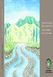
Ōtaki Floodplain Management Plan
A major flood in the Ōtaki River could cause millions of dollars worth of damage to property and community assets in the Ōtaki area. The social and psychological costs, although difficult…
alarm Published 01 Jun 1998 -
Nitrate management on the Hautere Plain
Intensive land use may cause significant adverse environmental effects
on groundwater quality in underlying and downgradient aquifers. One of
the effects of land use currently receiving increasing attention is the…There is no digital version of this document available, but you can get in touch with publications@gw.govt.nz to get a copy of the document.
alarm Published 01 Jun 1998 -
An investigation into water quality effects of transport
As part of its review of the Regional Land Transport Strategy the Transport
Planning and Policy Department of the Wellington Regional Council
sought to establish transport related environmental goals and…There is no digital version of this document available, but you can get in touch with publications@gw.govt.nz to get a copy of the document.
alarm Published 01 Jun 1998 -
Moera aquifer investigation
An investigation to improve definition of the hydrology of the Moera Aquifer
was undertaken during 1997/98. The primary focus of the investigation
was the definition of the potential for the…There is no digital version of this document available, but you can get in touch with publications@gw.govt.nz to get a copy of the document.
alarm Published 01 Jun 1998 -
Water quality of Lower Owhiro Stream
In April 1998 Wellington Regional Council met with the Owhiro Bay
Residents Association. The Association was concerned about the
influence of sewage overflows from the Landfill Road area on the…There is no digital version of this document available, but you can get in touch with publications@gw.govt.nz to get a copy of the document.
alarm Published 01 Jun 1998 -
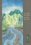
Otaki Floodplain Management Plan brochure
After a six-year planning process, the Otaki community has developed a
series of methods for dealing with erosion and flooding caused by the
Otaki River.
This brochure illustrates some of…There is no digital version of this document available, but you can get in touch with publications@gw.govt.nz to get a copy of the document.
alarm Published 01 Jun 1998 -
OTAKI FLOODPLAIN MANAGEMENT PLAN for the Otaki River and its environment
alarm Published 01 Jun 1998 -
-
The Ridge Track - Kaitoke Regional Park
The Ridge track is a moderately demanding 10 km walk through mature
beech forest and regenerating native bush. The track links the two
entrances of Kaitoke Regional Park and gives…There is no digital version of this document available, but you can get in touch with publications@gw.govt.nz to get a copy of the document.
alarm Published 01 May 1998 -
Queen Elizabeth Park - Sea, sun, sand...yours to enjoy
Queen Elizabeth Park covers 647 hectares of coastal land between
Paekakariki and Raumati South. Its easy access, safe swimming beach,
open country and picnic facilities make the Park…
alarm Published 01 May 1998