Our science staff frequently carry out targeted studies when routine monitoring has revealed a knowledge gap or a particular environmental problem.
Owhiro Stream catchment
The Owhiro Bay community has been concerned for a long time about the level of pollution and the state of the Owhiro Stream and its inhabitants.
After a community meeting in early 2017 we commissioned a report to bring together current knowledge on the state of the stream and the factors impacting on water quality.
Porirua Harbour and catchment programme
Since mid-2011 we have been modelling where the sediment entering Porirua Harbour comes from, and where it goes. This information will help us manage activities and land use practices in the surrounding catchments to reduce sedimentation rates in the harbour.
To assist with this we are installing sedimentation plates in the deeper parts of the harbour and turbidity sensors in the streams of several catchments to monitor sediment inputs. This research fulfills objectives and actions outlined in the Porirua Harbour and Catchment Strategy and Action Plan.
The strategy was launched in April 2012 with a vision for a healthy catchment, waterways and harbour.
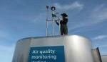
Masterton air quality
During winter 2012 we are monitoring air pollution near Chanel College in Masterton. This is an area of Masterton reported to experience problems with air quality in the cold winter months.
Our temporary monitoring station will measure the concentration of fine particles in the air that come from domestic fires, motor vehicles and soils. We will continue routine air quality monitoring at our Wairarapa College site.
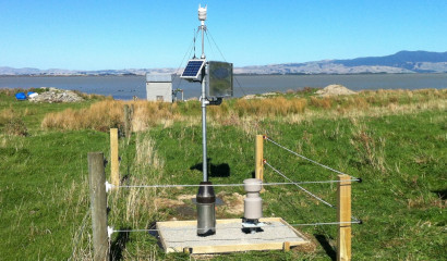
Lake Wairarapa water balance project
Lake Wairarapa is valued for its unique wildlife, rich fishery, irrigation supply, and flood water retention. These are all influenced by hydrological patterns. We know little about the lake water balance and a study is now underway to measure major hydrological inputs and outputs.
Monitoring sites are being established at several locations in and around the lake. These include meteorological sites (such as shown in the photo) collecting wind, rain and air temperature data, groundwater monitoring bores and an automatic flow recorder at the lake outlet.
Information from this monitoring will allow us to predict how the lake level will respond to climatic events such as drought. It will also help us understand more about land use impacts on the lake and adjoining wetlands, such as nutrient enrichment from nutrient runoff and inflow depletion from water abstractions.
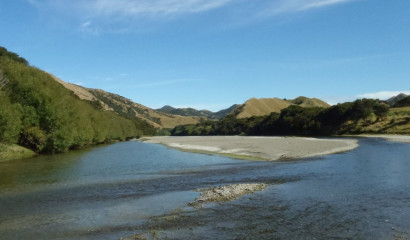
Pahaoa River water quality study
The Pahaoa River is located in the eastern Wairarapa and is the third largest catchment in the Wellington region.
We have just completed a year-long investigation in this river where we measured a range of water quality variables such as nutrients, sediment and faecal indicator bacteria at six locations throughout the catchment.
We also assessed the health of the invertebrate animals and algae present in the river. This investigation was undertaken to help provide up-to-date information on the current state and health of this river.
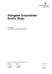
Waingawa Goundwater quality study
Elevated nitrate-nitrogen concentrations have been recorded for many years in a stream near Lowes Bush through our surface water SOE programme. The source of these elevated concentrations has often been attributed to the historic Waingawa Freezing Works, but the findings of this groundwater quality investigation indicate that the high nitrate levels are a result of the current land uses in the catchment.
State of the Environment (SoE) monitoring by Greater Wellington Regional Council (GWRC) in the Taratahi Groundwater Zone (GWZ), located south of the Waiohine River has reported elevated nitrate nitrogen (NO3-N)…
Read more here
date_range
Published 01 Jan 2018
Waingawa Groundwater Quality Study
If you would like more information about any of the research projects, please email us.
Get in touch
- Phone:
- 0800496734
- Email:
- info@gw.govt.nz